GPS denial attacks are particularly detrimental for drones
Reliable availability of GPS signals is critical to military and other navigation systems. Adversaries can launch GPS denial attacks through jamming (i.e., no GPS signals can be detected), spoofing (i.e., receivers get false GPS signals), or destruction of GPS satellites. Unmanned aerial vehicles (UAVs)—known as drones—that are reliant on the low-power radio frequency (RF) signals from orbiting satellites are particularly susceptible to signal disruptions from these attacks.
While large vehicles may be able to rely on alternate navigation—vision systems, radio ranging, lidar, altimeters, magnetic field measurements, etc.—drones have size, weight, and power (SWaP) limitations that make those solutions impossible to use. A simple, direct, and low-cost replacement for GPS is especially needed for SWaP-limited drones.
Collaborative system blends alternate data from multiple vehicles to aid navigation when GPS is unavailable
This robust Distributed PNT Chain enables a swarm of drones or other autonomous platforms to effectively navigate when they are denied GPS access. With this collaborative and distributed navigation system, drones share real-time PNT data blended from different members of the swarm—some of which may have GPS access.
The system uses a distributed factor graph as a filter, equivalent measurements between vehicles as a message-passing scheme, and a control method that refactors the filter as the network topology changes. A ranging radio measures distances between platforms, while the distributed filter and network controller gather sensor observations from across the swarm. These observations are quickly fused to generate a consistent positioning solution for each networked member of the swarm.
New information can be received from any platform (e.g., GPS, altimeter, inertial navigation systems [INS]) and is shared with all members of the swarm. As this new information is received, the swarm adapts and makes the most informed member the “teacher.” If another member receives additional information, it will switch roles to become the teacher. The resulting shared data and sensor fusion can enable reliable PNT information to be projected over long distances.
- Improves navigation: The collaborative system and its core distributed algorithms have the potential to dramatically improve navigation when GPS is unavailable. Simulated flights across the United States and over the Pacific Ocean suggested that the Distributed PNT Chain could reduce navigation errors in GPS-denied areas by more than 100-fold.
- Enhances reliability: The algorithms work with all available sensor data to significantly improve the robustness and reliability of drone teams.
- Minimizes processing burden: The Distributed PNT Chain algorithm uses graph factorization to minimize computational requirements.
- Reduces bandwidth: A network of decentralized solvers eases communication bandwidth requirements and allows much more flexibility in the communication network.
- Increases system versatility: The highly modular system is interoperable with pre-existing GPS INSs and supports variable and evolving platform geometries. The system’s computer architecture can include handheld computers, embedded computer systems, and other types of computing devices.
This technology benefits navigation in environments where GPS is denied or unavailable, including:
- Swarms of military drones or other autonomous platforms
- Ground vehicles
- Individual warfighters
- Larger air vehicles
- Ships and small boats

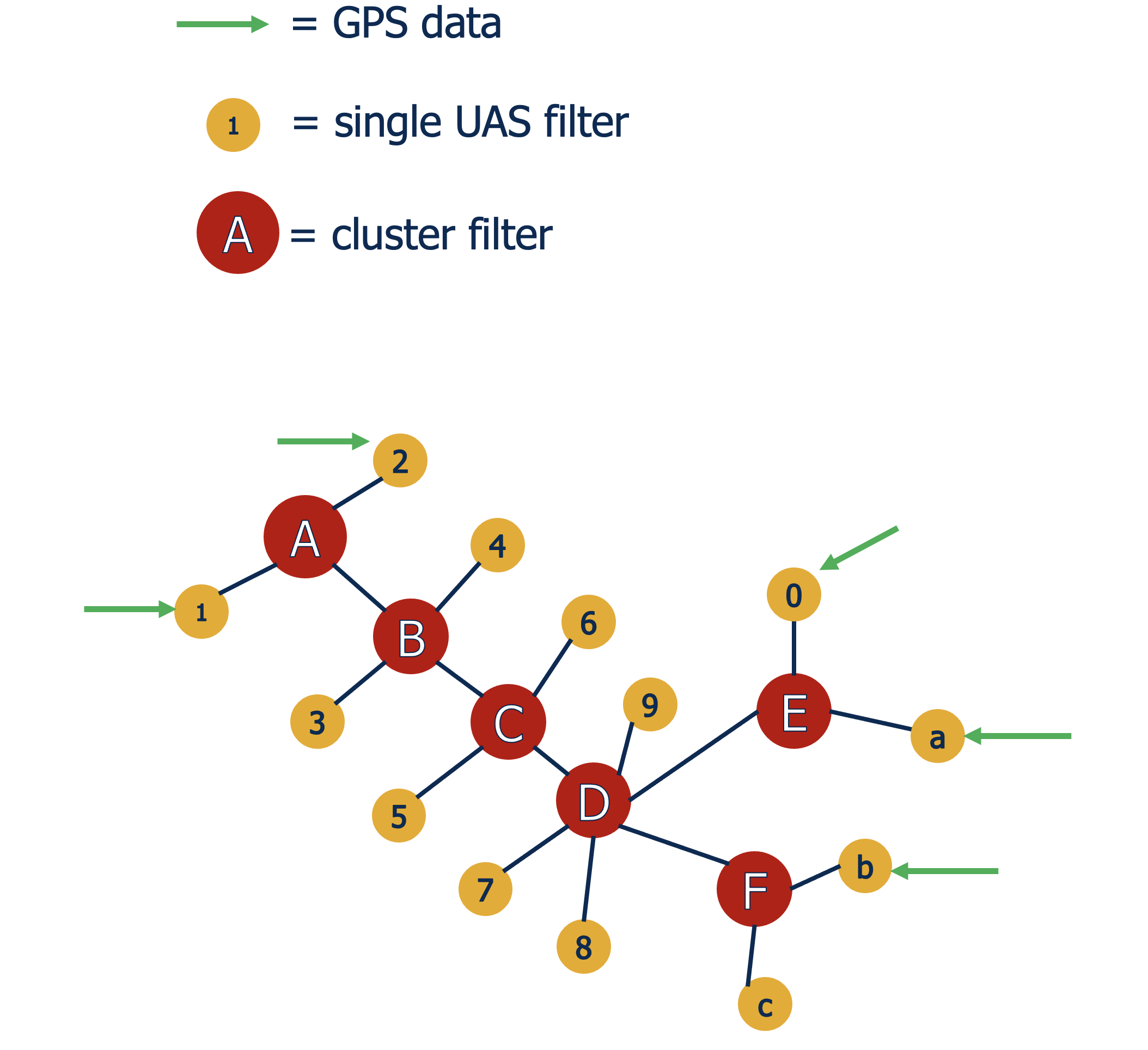
The flexible Distributed PNT Chain showing unmanned aerial system (UAS) drones clustered in pairs.

Each cluster makes the most informative cluster within communication range its “teacher.” In this example, the teacher is cluster “A,” as indicated by the blue arrows with the dot at the start of the line pointing to clusters “B” and “C.”

Disconnected clusters search for a new teacher. In this example, cluster “B” has become disconnected from cluster “A,” so cluster “C” becomes the teacher for cluster “B.”

If a student becomes better informed than the teacher, they switch roles. In this example, cluster “B” becomes the new teacher because the incoming GPS data for cluster “A” has weakened (as indicated by the dotted line for the green arrows) and then is lost.

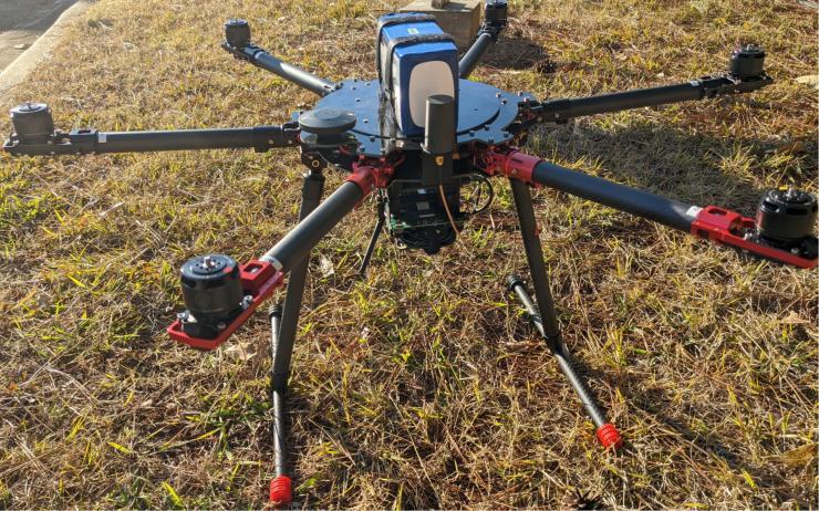
Georgia Tech Research Institute (GTRI) researchers used this UAV to flight test Distributed PNT Chain techniques developed to provide navigation support in the absence of GPS services. (Credit: GTRI)
